


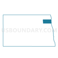
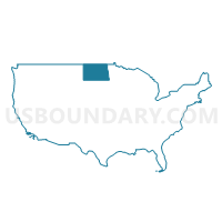
Walsh 16-05 Voting District, Walsh County, North Dakota
About
Outline

Summary
| Unique Area Identifier | 642367 |
| Name | Walsh 16-05 Voting District |
| County | Walsh County |
| State | North Dakota |
| Area (square miles) | 138.07 |
| Land Area (square miles) | 135.87 |
| Water Area (square miles) | 2.20 |
| % of Land Area | 98.41 |
| % of Water Area | 1.59 |
| Latitude of the Internal Point | 48.28818610 |
| Longtitude of the Internal Point | -97.26545660 |
Maps

Graphs
Select a template below for downloading or customizing gragh for Walsh 16-05 Voting District, Walsh County, North Dakota


Neighbors
Neighoring Voting District (by Name) Neighboring Voting District on the Map
- Big Woods Twp. Voting District, Marshall County, MN
- Grand Forks 19-18 Voting District, Grand Forks County, ND
- Grand Forks 19-23 Voting District, Grand Forks County, ND
- Oak Park Twp. Voting District, Marshall County, MN
- Oslo Voting District, Marshall County, MN
- Walsh 16-04 Voting District, Walsh County, ND
- Walsh 16-06 Voting District, Walsh County, ND
- Walsh 16-18 Voting District, Walsh County, ND
Top 10 Neighboring County Subdivision (by Population) Neighboring County Subdivision on the Map
- Minto city, Walsh County, ND (604)
- Oslo city, Marshall County, MN (330)
- Oakwood township, Walsh County, ND (228)
- Turtle River township, Grand Forks County, ND (174)
- Walsh Centre township, Walsh County, ND (154)
- Oak Park township, Marshall County, MN (131)
- Harriston township, Walsh County, ND (131)
- Walshville township, Walsh County, ND (112)
- Acton township, Walsh County, ND (96)
- Pulaski township, Walsh County, ND (88)
Top 10 Neighboring Place (by Population) Neighboring Place on the Map
Top 10 Neighboring Elementary School District (by Population) Neighboring Elementary School District on the Map
Top 10 Neighboring Unified School District (by Population) Neighboring Unified School District on the Map
- Grafton Public School District 3, ND (5,299)
- Warren-Alvarado-Oslo School District, MN (3,651)
- Midway Public School District 128, ND (1,343)
- Minto Public School District 20, ND (1,095)
Top 10 Neighboring State Legislative District Lower Chamber (by Population) Neighboring State Legislative District Lower Chamber on the Map
- State House District 1B, MN (36,188)
- State House District 16, ND (12,013)
- State House District 19, ND (11,131)
Top 10 Neighboring State Legislative District Upper Chamber (by Population) Neighboring State Legislative District Upper Chamber on the Map
- State Senate District 1, MN (71,334)
- State Senate District 16, ND (12,013)
- State Senate District 19, ND (11,131)
Top 10 Neighboring 111th Congressional District (by Population) Neighboring 111th Congressional District on the Map
Top 10 Neighboring Census Tract (by Population) Neighboring Census Tract on the Map
- Census Tract 803, Marshall County, MN (2,310)
- Census Tract 114, Grand Forks County, ND (2,273)
- Census Tract 9578, Walsh County, ND (1,677)